 CYCLONES
OR HURRICANES CYCLONES
OR HURRICANES  |
3st
PART
CLASSIFICATION
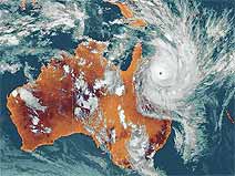
AND CONSEQUENCES OF CYCLONES
It is unimaginable
to see all the energy that can release a cyclone.
It can release energy more than 15 atomic bombs
of type Hiroshima to the second. The wind speed
is the main source for classified cyclones...
We talk about :
- Low tropical depression when the wind
is lower than 37 mph (60 km/h) ;
- Moderate tropical storm when winds are higher
than 37 mph (60 km/h) but lower than 56 mph
(90 km/h) ;
-Tropical storm when winds are higher than
56 mph (90 km/h) and lower than 74,5 mph (120
km/h) ;
-Tropical cyclone or hurricane when winds are
higher than 74,5 mph (120 km/h) ;
For classifying cyclones since
1981 the Saffir-Simpson scale is used to give
an idea of the damage that could cause the winds
and storm surge during the cyclone. This scale
is 1 to 5.
|
CATEGORY
|
PRESSURE
|
WIND
|
DAMAGES
|
|
1
|
> or = 980 hPa
|
74 to 95 mph
(118 to 153 km/h)
(e.g. hurricane Jerry (1989))
|
Some
minor damage
|
|
2
|
979 to 965 hPa
|
95 to 110 mph
(154 to 177 km/h)
(e.g. cyclone Bob (1991))
|
Major
damage and
plants uprooted
|
|
3
|
964 to 945 hPA
|
111 to 130 mph
(178 to 209 km/h)
(e.g. hurricane Gloria (1985))
|
Roofs,
windows and doors will be
damaged and uprooted trees
|
|
4
|
944 to 920 hPa
|
131 to 155 mph
(210 to 249 km/h)
(e.g. hurricane Hugo (1989))
|
No
mobile home not there will survive. Significant
damage to the
basements of the houses.
|
|
5
|
lower
than 919 hPa
|
more to 155 mph
(more to 249 km/h)
(e.g. hurricane Gilbert 885 hPa)
|
Destruction
of large buildings.
Multiple roof collapse.
Very extensive damage
|
The power of tropical
cyclones is evaluated according to the Saffir-Simpson
scale.
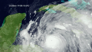
Cyclones can do much damage
when they arrive on the coasts. The cause of
their devastating power is exercised in three
areas : wind, rain and the sea.
 Atmosphere
 Atmos. turbulences
 Ocean and climate
 Natural Factors
 Climatic and oceanic
phenomenas
Climatic and oceanic
phenomenas  Photos, videos
 Diverse
 Simulations...


