Atmosphere
 Atmos. turbulences
 Ocean and climate
 Natural Factors
 Climatic and oceanic phenomenas
 Photos, videos
 Diverse
 Simulations...
1st PART
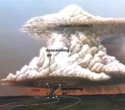
A tornado is a swirling column of wind manifesting by a funnel cloud (tuba) which form along the base cumulonimbus clouds and accompanied by rain and sometimes a thunderstorm or hail. 99 % of them spin anti-clockwise in the northern hemisphere, and clockwise in the southern hemisphere. The tornadoes can successive rise and fall and touch the ground from time to time on its way. Comparable to tornadoes, but more modest, there is also the waterspout that form over bodies of water (lakes, oceans, seas) under conditions of moderate instability. Their wind speed is less than 74 mph (120 km/h), the pressure drop is about 20 to 30 hPa, heir diameter is less than 30 m and their shelf life between 5 and 20 minutes. Tornadoes are characterized by : - violent winds with above 400 km/h (248 mph) were observed. But the wind speed inside a tornado is difficult to measure, but estimated at 410 mph (660 km/h) ; - a sharp drop in pressure that can reach or even exceed 100 hPa during a tornado. This corresponds to a drop of a tenth of the surface pressure, thus becomes comparable to those prevailing sea level in the center of hurricanes as David (1979), Allen (1980), Hugo (1989) and Andrew (1992), to mention only the most famous among those who affected the Caribbean region in recent decades. - a diameter of the tip of the funnel cloud 15 to 30
m. But the diameter of the tornado varies from 15 m to 1
km ;
Schema of a tornado
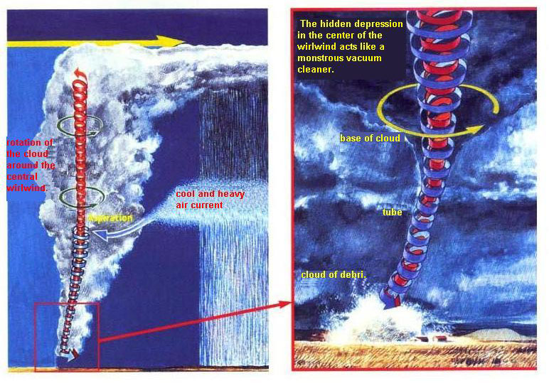
As the warm, moist winds are attracted by depression, which generates a twisted mouvment within the thundercloud movement, swirling faster and faster. In extreme violence, the rotation is amplified by a powerful upward and swirling air column in the heart of the storm giving rise to a mesocyclone (cyclonic circulation at the scale of a storm) that is caused by the reaction of hot and cold air streams in a given area of the storm. The central column speed up its rotation and reaches the ground, creating a tornado. If the cumulonimbus which is formed to a very high altitude is above the jet stream, then the storm cloud begins to turn (a so-called giant cell).
The figures show the evolution of
the formation of a tornado : warm, moist air rises gradually
spiral and
DYNAMICS OF A TORNADO
A video explaining the formation of tornadoes A tornado may last for several minutes or greater than one hour. After reaching its maximum intensity, tuba shrinks then bowed horizontal and deforms ending by die.
Click here to see this simulation video
WARNING
|
|||||||||||||||||||||