3st
PART

|
Since the early 20th century a decrease in rainfall
in the Sahel has caused a dramatic increase in the desert
between 1968 and 1986, accompanied by a drought. More
than 20 million hectares of formerly productive lands
are transformed into barren desert each year (area greater
than half of the British Isles). While all indications
are that once the drought was limited to relatively
small areas, their durations, their extensives and damages
resulting constantly increased during the past 100 years.
|
|
 |
|
During the drought of 1968 to 1973, often called
"great drought" 16 countries were affected
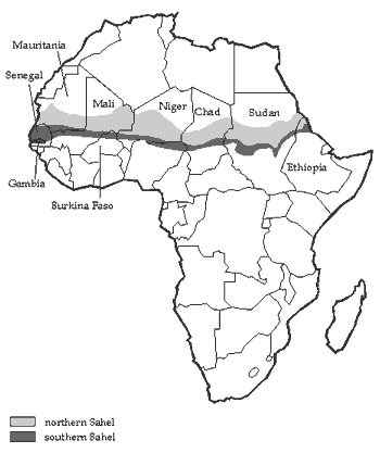
(the islands of Cape Verde, Senegal, Gambia, Mali, Mauritania,
Burkina Faso, Chad, Niger, Benin, Nigeria, the Central
African Republic, the Libya, the Sudan, Somalia, Djibouti
and Ethiopia). From 1980 to 1984, 14 other nations of
central and southern Africa experienced a drought.
The rainfall Chronicles :
-1910 to 1916 : period of drought ;
-1920 to 1970 : wet period mostly 1950 to 57 (7 years)
;
-1970-2003 : drought especially between 1971 to 1976
and 1980 to 1988, the longest and most intense of the
century.
- but the drought slowly slowed since 1990.
|
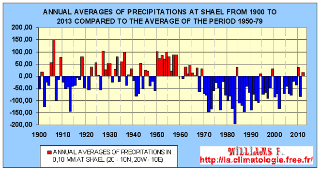
The evolution of the anomaly of the rainfall
in the Sahel from 1900
to now compared to the average from 1950 to 1979. Source JJASO.
Climatic phenomena AMO
and TAV are those that have the
most influence on rainfall over West Africa. Droughts in the
Sahel have occurred primarily when the index of the AMO was
negative either when the temperature anomaly in the North Atlantic
was negative and opposite in the South Atlantic..
Click
to see more info on the relationship between AMO and drought
in the Sahel
The Sahelian zone underwent repeated climatic
fluctuations as in all regions of our planet. In 2000 years
the desert has almost doubled and the area of Lake Chad has
decreased significantly.
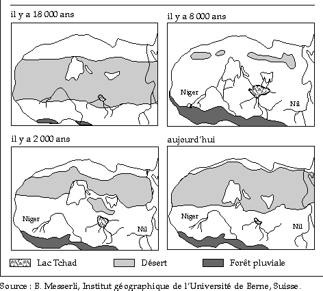
The evolution of the environment according
to the climate in the Sahel since 18.000
years
The "great drought" from 1968 to
1973, with a volume of rainfall of 15-40% lower than the average,
has caused a loss of 600_000 tons on the harvest of cereals.
In 1984 the rainfall is estimated as being fallen 25% and the
total flow of Chari-Logone river was only about 20% of the long-term
average. What has resulted in the fall in the level of Lake
Chad. That demonstrates the effect of a reduction in the rainfall
of 25% on the flow of a river. Thus the area of Lake Chad 23.500
km2 en 1963 in 1963 was more than 2.000
km2 in 1985.
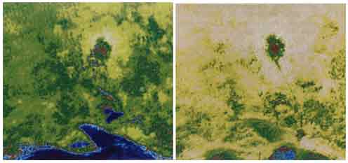
In Mali Timbuktu was facing major challenges
of significant climate change
occurred in the region. Above, two images of the city represented
by the brown area
in the center of the upper part of the photograph. Left in 1976
and right in 1987, the
blue areas represent the floodplain of the River Niger while
the sand dunes are yellow.
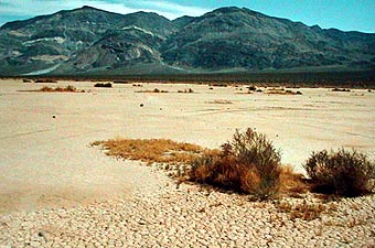
during the dry season in the West of the
Sahel

during the wet season in the West in the Sahel
In other countries there is the same scenario that in
the Sahel. This is the case in Namibia located south of Africa.
For some parts of Southern Africa, crops are shrinking. Finally,
it is expected that mosquitoes vectors of malaria spread until
Namibia.

Click
here to enlarge this photo which shows us that Namibia sand
dunes advance and may engulf the surrounding vegetation

Click
here to enlarge photo of drained
Lake of Dead Vlei Sossusvlei Namibia
.gif)
WARNING
Patricia
Régnier helped me correct mistakes, please you to visit
her
blog
I’m not english speaker, some improprieties can appear
to english masters.
Could you help me reporting by mail any fault you read. Thank
you for all.
Contact :
|
 Atmosphere
 Atmos. turbulences
 Ocean and climate
 Natural Factors
 Climatic and oceanic phenomenas
 Photos, videos
 Diverse
 Simulations...


)
)
)